
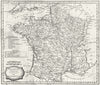


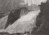


Napoleonic Europe and the waterfalls of Switzerland share the pages of A general view of the World, the Reverend Ezekiel Blomfield's geographical, historical and philosophical account published at Bungay in 1807 by C. Brightly and T. Kinnersley. Its copperplate maps show France divided into its departments, together with Germany and England and Wales, all drawn as the territories stood at the time. Engraved views of the Rhine Falls at Schaffhausen and the Staubbach set natural spectacle beside the political map.
EU orders up to €150 are sent VAT- and duty-paid — no additional taxes on arrival
Authenticity Guaranteed - We only sell original antique & vintage items
Can we help? Call us on +44-208-960-3476 • FAQs
All our products are exempt from US tariffs — no additional duties or taxes payable on arrival.


- Shop by Country
- Shop by Cartographer
- Shop Maps by Type
- Shop Prints by Subject