
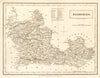

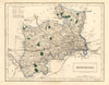

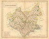

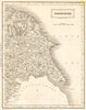

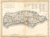

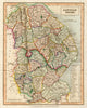

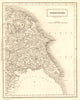
Sidney Hall drew and engraved the county maps for John Gorton's A Topographical Dictionary of Great Britain & Ireland, published in London by Chapman and Hall around 1830 to 1833. The maps here include Berkshire, Middlesex, Leicestershire, Sussex and Lincolnshire, with eastern Yorkshire on a sheet of its own, the large county being divided to fit the page. They let readers of the gazetteer find each town within its county.
EU orders up to €150 are sent VAT- and duty-paid — no additional taxes on arrival
Authenticity Guaranteed - We only sell original antique & vintage items
Can we help? Call us on +44-208-960-3476 • FAQs
All our products are exempt from US tariffs — no additional duties or taxes payable on arrival.


- Shop by Country
- Shop by Cartographer
- Shop Maps by Type
- Shop Prints by Subject