


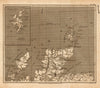


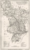


Small, neat county maps made for a reference book are the appeal of A Topographical Dictionary of the United Kingdom. Benjamin Pitts Capper's dictionary was published by Richard Phillips in 1808, combining descriptions of places with statistical and administrative information, and the maps here include early and later impressions into the 1820s. The English counties form the main sequence, with maps of Scotland, Ireland and the British Isles completing it, each showing county divisions, towns and roads in a compact engraved format. Credits to engravers such as Henry Cooper record part of the book's production. The map gave the county outline, and the dictionary supplied the account of each place.
EU orders up to €150 are sent VAT- and duty-paid — no additional taxes on arrival
Authenticity Guaranteed - We only sell original antique & vintage items
Can we help? Call us on +44-208-960-3476 • FAQs
All our products are exempt from US tariffs — no additional duties or taxes payable on arrival.


- Shop by Country
- Shop by Cartographer
- Shop Maps by Type
- Shop Prints by Subject