


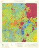

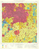


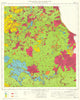


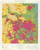


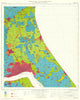


Colour-coded farmland laid over an Ordnance Survey landscape sets the provisional Agricultural Land Classification of England and Wales apart from any ordinary road or county atlas. Issued in the late 1960s and 1970s through the Ministry of Agriculture, Fisheries and Food, these maps grade land quality at a regional planning scale, with towns and transport routes visible beneath the colours. The numbered sheets cover coastal plains, claylands, downland and river basins, among them the Humberhead Levels, the Norfolk Broads, the Vale of Pewsey and the South Hams. This early assessment predates the later subdivision of Grade 3, and a sheet index shows how the districts fit together.
EU orders up to €150 are sent VAT- and duty-paid — no additional taxes on arrival
Authenticity Guaranteed - We only sell original antique & vintage items
Can we help? Call us on +44-208-960-3476 • FAQs
All our products are exempt from US tariffs — no additional duties or taxes payable on arrival.


- Shop by Country
- Shop by Cartographer
- Shop Maps by Type
- Shop Prints by Subject