


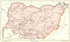


Colonial West Africa, mapped for a survey of its crops and forests, appears in these maps from Gerald C. Dudgeon's Agricultural and Forest Products of British West Africa, published by John Murray in 1911 and catalogued under the heading Agricultural products of British West Africa. Stanford's Geographical Establishment prepared the colour maps, which cover northern and southern Nigeria, the Ashanti and Northern Territories of the Gold Coast, Gambia and Sierra Leone, together with a general map of West Africa. Their boundaries and place names belong to the years of British rule, before the modern independent states.
EU orders up to €150 are sent VAT- and duty-paid — no additional taxes on arrival
Authenticity Guaranteed - We only sell original antique & vintage items
Can we help? Call us on +44-208-960-3476 • FAQs
All our products are exempt from US tariffs — no additional duties or taxes payable on arrival.


- Shop by Country
- Shop by Cartographer
- Shop Maps by Type
- Shop Prints by Subject