


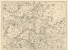

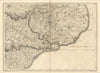

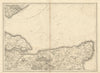


The countryside around London before the suburbs is laid out in fine detail in these antique maps by John Andrews and Andrew Dury, whose surveys of southern England date from the later eighteenth century. The sheets come from a later issue of their extensive map of the country around London, dated 1818. Andrews lived from 1736 to 1809, and Dury's recorded activity belongs mainly to the middle and later eighteenth century, so this edition circulated well after their partnership. Covering the Chilterns, the Thames valley, Essex, Kent, Sussex and Hampshire, the maps link inland market towns with the Channel coast, with roads, settlements and country estates surveyed before London spread far into these counties.
EU orders up to €150 are sent VAT- and duty-paid — no additional taxes on arrival
Authenticity Guaranteed - We only sell original antique & vintage items
Can we help? Call us on +44-208-960-3476 • FAQs
All our products are exempt from US tariffs — no additional duties or taxes payable on arrival.


- Shop by Country
- Shop by Cartographer
- Shop Maps by Type
- Shop Prints by Subject