


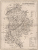


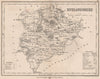


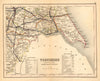

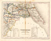


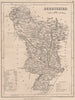


Polling places and country seats are marked across these antique county maps by Joshua Archer (1792–1863), the London cartographer, copperplate printer and engraver who supplied the maps for Thomas Dugdale's Curiosities of Great Britain, a topographical work whose county sheets circulated in several nineteenth-century issues. Dating from 1845, they cover the counties of England and Wales, with a national road map. Canals, roads, towns and administrative divisions accompany the named seats and electoral information; Yorkshire is divided into regional sections while small counties such as Rutland have a sheet of their own, and older spellings and detached portions of counties show arrangements unfamiliar today.
EU orders up to €150 are sent VAT- and duty-paid — no additional taxes on arrival
Authenticity Guaranteed - We only sell original antique & vintage items
Can we help? Call us on +44-208-960-3476 • FAQs
All our products are exempt from US tariffs — no additional duties or taxes payable on arrival.


- Shop by Country
- Shop by Cartographer
- Shop Maps by Type
- Shop Prints by Subject