


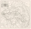


Marengo, Jena, Eylau and Waterloo are laid out in terrain, fortifications and successive positions in the Atlas de l'histoire du consulat et de l'Empire. Its maps were issued in 1859, drawn by A. Dufour and Duvotenay under the direction of Adolphe Thiers for his history. Overview sheets show the changing map of Europe, detailed plans follow Friedland and the other great battles, the sieges and engagements of the Peninsular War, and the Russian campaign at Moscow, Smolensk and the Berezina, while Egypt, Saint-Domingue and naval actions extend the coverage.
EU orders up to €150 are sent VAT- and duty-paid — no additional taxes on arrival
Authenticity Guaranteed - We only sell original antique & vintage items
Can we help? Call us on +44-208-960-3476 • FAQs
All our products are exempt from US tariffs — no additional duties or taxes payable on arrival.


- Shop by Country
- Shop by Cartographer
- Shop Maps by Type
- Shop Prints by Subject