


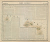


Sennaar, Darfour and Mocaranga appear on these maps from the Africa volume of Atlas universel, Philippe Vandermaelen's ambitious Brussels atlas of 1827, whose sheets could be assembled into a globe. Every map used a common scale and projection, and lithography, with printing credited to Henri Ode, made the huge project possible. The African sheets stretch from the Azores and the Mediterranean coast across the Sahara and the Nile valley to the western coasts, Angola, Mozambique and southern Africa, in the vocabulary of European compilers before the colonial partition. Coasts, rivers, oases and inland regions are mapped in very uneven detail, and the uniform framework makes the gaps in European knowledge especially plain.
EU orders up to €150 are sent VAT- and duty-paid — no additional taxes on arrival
Authenticity Guaranteed - We only sell original antique & vintage items
Can we help? Call us on +44-208-960-3476 • FAQs
All our products are exempt from US tariffs — no additional duties or taxes payable on arrival.


- Shop by Country
- Shop by Cartographer
- Shop Maps by Type
- Shop Prints by Subject