
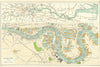

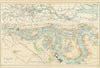

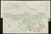


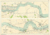


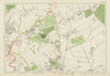

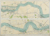

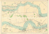


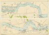


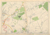


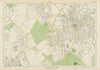


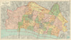

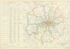


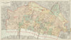


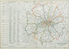


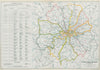

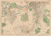


Bacon’s Large-Scale Atlas of London and Suburbs (and the later New Large-Scale Atlas of London and Suburbs), published by G.W. Bacon & Co. in London, was one of the most detailed and widely used atlases of the capital in the late 19th and early 20th centuries. The atlas was first issued in the 1880s, drawing on Ordnance Survey data, and was updated in numerous editions to reflect London’s rapid urban expansion. Further editions appeared up to at least 1927, with each version incorporating new developments such as railway lines, tramways, borough boundaries, and new suburban growth. Later editions included thematic maps of the capital. Issues in folio format, the atlas featured large, finely lithographed sheets, often hand-coloured. Its practical scale, clarity, and frequent revisions made it a key reference during a transformative period in London’s development, and it remains a rich historical source for studying the city’s Victorian and Edwardian geography.
EU orders up to €150 are sent VAT- and duty-paid — no additional taxes on arrival
Authenticity Guaranteed - We only sell original antique & vintage items
Can we help? Call us on +44-208-960-3476 • FAQs
All our products are exempt from US tariffs — no additional duties or taxes payable on arrival.
- Shop by Country
- Shop by Cartographer
- Shop Maps by Type
- Shop Prints by Subject