
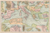


Railways, battle sites, explorers' polar routes and comparative statistics fill Bacon's Popular Atlas of the World, which set political geography beside transport and exploration at the end of the nineteenth century. The maps here span issues from the 1890s into the early twentieth century, with city and harbour insets adding detail. Canada, Australia and colonial Africa carry administrative names that have since changed, and the Asian sheets record European spheres of influence and older place names. The polar maps also show contemporary systems of time, diagrams compare marine tonnage, population and land area, and Mediterranean ports and commercial routes give the atlas a practical bent.
EU orders up to €150 are sent VAT- and duty-paid — no additional taxes on arrival
Authenticity Guaranteed - We only sell original antique & vintage items
Can we help? Call us on +44-208-960-3476 • FAQs
All our products are exempt from US tariffs — no additional duties or taxes payable on arrival.


- Shop by Country
- Shop by Cartographer
- Shop Maps by Type
- Shop Prints by Subject