


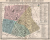

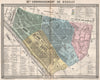

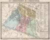

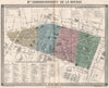


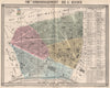


Paris is mapped arrondissement by arrondissement, just as its municipal boundaries were enlarged, in these sheets issued under the imprint of Gustave Barba around 1860. They come from works associated with Émile de La Bédollière, including Le Nouveau Paris and its companion account of the surroundings, and the plans name districts such as the Temple, Bourse, Reuilly, Observatoire and Vaugirard against their numbered administrative areas. Barba was the publisher; the maps and illustrations were supplied by contributors including Erhard and Gustave Doré, a distinction that matters when attributing them.
EU orders up to €150 are sent VAT- and duty-paid — no additional taxes on arrival
Authenticity Guaranteed - We only sell original antique & vintage items
Can we help? Call us on +44-208-960-3476 • FAQs
All our products are exempt from US tariffs — no additional duties or taxes payable on arrival.


- Shop by Country
- Shop by Cartographer
- Shop Maps by Type
- Shop Prints by Subject