


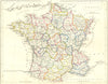
Maps of Germany, France and the Isle of Thanet show that James Barclay's Universal Dictionary taught geography as well as words. They were published between 1806 and 1848 in its illustrated editions. Germany appears in different treatments of its territories, alongside Prussia, France, Belgium and Luxembourg, and maps of England and Wales show the railways. The Isle of Thanet is a more decorative local sheet associated with Thomas Moule, and Barlow and Becker are among the other names attached to the mapping.
EU orders up to €150 are sent VAT- and duty-paid — no additional taxes on arrival
Authenticity Guaranteed - We only sell original antique & vintage items
Can we help? Call us on +44-208-960-3476 • FAQs
All our products are exempt from US tariffs — no additional duties or taxes payable on arrival.


- Shop by Country
- Shop by Cartographer
- Shop Maps by Type
- Shop Prints by Subject