


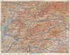


Loch Lomond, the Trossachs and the passages of the North Minch appear in these maps from the Blue Guide to Scotland, made for the traveller exploring the country by road and sea. They include the second edition of 1932, published by Ernest Benn and edited by Findlay Muirhead, together with later material. Regional sheets cover central Scotland, the Grampians, the north-west Highlands and Shetland, while local maps concentrate on Melrose and Fort William and the surroundings of Edinburgh and Stirling. Plans of Aberdeen, Inverness, Perth and Ayr cover the towns where the routes stop.
EU orders up to €150 are sent VAT- and duty-paid — no additional taxes on arrival
Authenticity Guaranteed - We only sell original antique & vintage items
Can we help? Call us on +44-208-960-3476 • FAQs
All our products are exempt from US tariffs — no additional duties or taxes payable on arrival.


- Shop by Country
- Shop by Cartographer
- Shop Maps by Type
- Shop Prints by Subject