


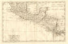


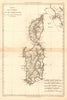


From the Netherlands to the Guinea coast and the Antilles, these antique maps by the French cartographer Rigobert Bonne cover a wide sweep of the eighteenth-century world. The sheets here are dated 1770–1790 and also take in the Canary and Cape Verde islands, Louisiana and Florida and the southern United States. Their French titles preserve the place names and regional groupings of the original publications, and an island sheet set beside a continental map shows how Bonne judged scale and detail for each subject.
EU orders up to €150 are sent VAT- and duty-paid — no additional taxes on arrival
Authenticity Guaranteed - We only sell original antique & vintage items
Can we help? Call us on +44-208-960-3476 • FAQs
All our products are exempt from US tariffs — no additional duties or taxes payable on arrival.


- Shop by Country
- Shop by Cartographer
- Shop Maps by Type
- Shop Prints by Subject