


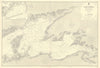

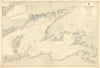


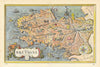


Megaliths at Carnac, the naval port of Brest and the islands of Ushant and Belle-Île all appear in these maps of Brittany, an independent duchy until its union with the French Crown in 1532. Printed between 1603 and 1962, they run from early work by Bertius, Langenes, Janssonius, Mallet and Bonne to Admiralty sea charts, German naval maps of 1943 and Ward Lock travel plans. The prints include nineteenth-century illustrations of traditional costume, historical battles and heraldic arms, together with views of Rennes, Nantes, Morlaix and Lamballe.
EU orders up to €150 are sent VAT- and duty-paid — no additional taxes on arrival
Authenticity Guaranteed - We only sell original antique & vintage items
Can we help? Call us on +44-208-960-3476 • FAQs
All our products are exempt from US tariffs — no additional duties or taxes payable on arrival.


- Shop by Country
- Shop by Cartographer
- Shop Maps by Type
- Shop Prints by Subject