


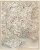

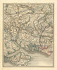


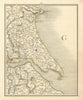


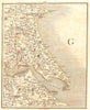


Land's End, the Lizard and the Cornish ports from Falmouth to Looe are among the coverage of Cary's New Map of England & Wales, published by J. Cary in London between 1794 and 1824. The sectional sheets record topography, roads and coasts across England, Wales and parts of Scotland. Salisbury Plain and the Dorset coast face the English Channel, and Cornish sheets name Truro, Fowey, Bodmin, St Austell, Penzance, St Ives, Redruth and Camborne. Further sections cover Hampshire, Surrey, Sussex, the Cotswolds, the Lake District, Yorkshire, Lincolnshire, Lancashire, London and the Home Counties, reaching as far as the Scottish Borders.
EU orders up to €150 are sent VAT- and duty-paid — no additional taxes on arrival
Authenticity Guaranteed - We only sell original antique & vintage items
Can we help? Call us on +44-208-960-3476 • FAQs
All our products are exempt from US tariffs — no additional duties or taxes payable on arrival.


- Shop by Country
- Shop by Cartographer
- Shop Maps by Type
- Shop Prints by Subject