


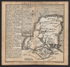


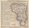


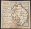


Small in format and full of practical notes, the county maps of Chorographia Britanniae were prepared by Thomas Badeslade and engraved by William Henry Toms for publication in London in 1742. They cover England and Wales, from Cornwall and Devon to Yorkshire and Cumberland, including the old counties of Middlesex, Huntingdonshire and Westmorland. Orientation varies, with Cornwall turned towards the southwest and other sheets placing west or east at the top, and towns, rivers and county outlines sit beside brief notes on markets and parliamentary representation. Different early issues are represented.
EU orders up to €150 are sent VAT- and duty-paid — no additional taxes on arrival
Authenticity Guaranteed - We only sell original antique & vintage items
Can we help? Call us on +44-208-960-3476 • FAQs
All our products are exempt from US tariffs — no additional duties or taxes payable on arrival.


- Shop by Country
- Shop by Cartographer
- Shop Maps by Type
- Shop Prints by Subject