


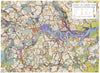
Prepared for the London County Council in the middle of the war, J. H. Forshaw and Patrick Abercrombie’s County of London Plan, published by Macmillan in 1943, set out to rebuild a bombed, congested and overcrowded capital as a city of communities. Its most famous map, the ‘potato map’ drawn by Arthur Ling and D. K. Johnson, pictures London as a cluster of neighbourhoods rather than streets. Other plates survey bomb damage, sprawl, population density and traffic congestion at Piccadilly Circus, and propose a park system, an inner ring road, zoning and new reconstruction areas in Stepney, Bethnal Green, Hoxton and Bermondsey. Air views and photographs show the planned South Bank, a parkway from Hyde Park Corner to Marble Arch, the Bloomsbury university precinct and the housing estates the planners admired: a vivid record of wartime idealism.
EU orders up to €150 are sent VAT- and duty-paid — no additional taxes on arrival
Authenticity Guaranteed - We only sell original antique & vintage items
Can we help? Call us on +44-208-960-3476 • FAQs
All our products are exempt from US tariffs — no additional duties or taxes payable on arrival.


- Shop by Country
- Shop by Cartographer
- Shop Maps by Type
- Shop Prints by Subject