


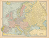


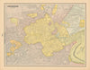

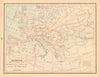

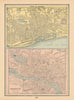


Oklahoma and Indian Territory, time zones and the stars all appear in these antique maps by George F. Cram (1842–1928), the American map publisher who joined Rufus Blanchard's business after the Civil War and went on to found the firm that carried his own name. The material here is dated 1894 and has the breadth of a general reference atlas: state and county maps, city plans and world maps, with sheets on territorial expansion and Indigenous nations. European cities, religions, astronomical diagrams and historical reconstructions complete the range.
EU orders up to €150 are sent VAT- and duty-paid — no additional taxes on arrival
Authenticity Guaranteed - We only sell original antique & vintage items
Can we help? Call us on +44-208-960-3476 • FAQs
All our products are exempt from US tariffs — no additional duties or taxes payable on arrival.


- Shop by Country
- Shop by Cartographer
- Shop Maps by Type
- Shop Prints by Subject