


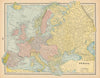


City plans of St Louis and Atlanta, Texas county maps, celestial diagrams and charts of world religions all share the pages of Cram's Universal Atlas, published by George F. Cram in Chicago and New York in 1894. Plans cover Columbus, Cincinnati and even London, and state maps include Minnesota, Arkansas, Oklahoma and the Carolinas. Astronomical plates explain the seasons and solstices, while world plates show the hemispheres, national coats of arms and historical distribution after the Flood. Canada's North West Territory, Mexico, Central America, the European nations and biblical regions extend the coverage.
EU orders up to €150 are sent VAT- and duty-paid — no additional taxes on arrival
Authenticity Guaranteed - We only sell original antique & vintage items
Can we help? Call us on +44-208-960-3476 • FAQs
All our products are exempt from US tariffs — no additional duties or taxes payable on arrival.


- Shop by Country
- Shop by Cartographer
- Shop Maps by Type
- Shop Prints by Subject