
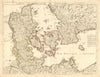


Guillaume Delisle brought the scientific ambition of early eighteenth-century French cartography to maps of Asia, Africa, the Americas and Europe. The antique maps here cover northern and central Asia, the Indian kingdoms and Sri Lanka, Africa's coastal regions, colonial North America and the Spanish Main, with Denmark and Swabia among the European sheets. He lived from 1675 to 1726, became a member of the Académie des sciences and geographer to the king, and drew on accumulated observations to improve his maps. Some sheets were issued in his lifetime; others are later editions associated with Philippe Buache or Covens and Mortier, which kept his work in circulation after his death.
EU orders up to €150 are sent VAT- and duty-paid — no additional taxes on arrival
Authenticity Guaranteed - We only sell original antique & vintage items
Can we help? Call us on +44-208-960-3476 • FAQs
All our products are exempt from US tariffs — no additional duties or taxes payable on arrival.


- Shop by Country
- Shop by Cartographer
- Shop Maps by Type
- Shop Prints by Subject