


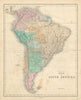


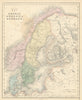


The Roman world, Hadrian's Wall and the railways of Britain share the pages of the Edinburgh Imperial Atlas, letting a reader turn from ancient provinces to modern countries. Gall & Inglis published The Edinburgh Imperial Atlas, Ancient and Modern in Edinburgh around 1850, covering continents and hemispheres, British and Irish railways, divided Poland, Italy before unification and the Caribbean. Ancient Gaul, Germania, Italy and Greece form a classical strand, together with the world as known to classical writers, and Palestine and Egypt combine biblical, ancient and modern place names.
EU orders up to €150 are sent VAT- and duty-paid — no additional taxes on arrival
Authenticity Guaranteed - We only sell original antique & vintage items
Can we help? Call us on +44-208-960-3476 • FAQs
All our products are exempt from US tariffs — no additional duties or taxes payable on arrival.


- Shop by Country
- Shop by Cartographer
- Shop Maps by Type
- Shop Prints by Subject