


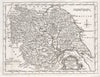

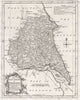


Thomas Kitchin engraved the county maps for England Illustrated, a survey of the natural history, geography and antiquities of England and Wales published in London for Robert and James Dodsley in 1764. The maps here include Huntingdonshire, Cambridgeshire, Westmorland and Yorkshire, with a separate sheet for the East Riding. The original work also illustrated towns, buildings and antiquities, but this collection concentrates on Kitchin's county maps.
EU orders up to €150 are sent VAT- and duty-paid — no additional taxes on arrival
Authenticity Guaranteed - We only sell original antique & vintage items
Can we help? Call us on +44-208-960-3476 • FAQs
All our products are exempt from US tariffs — no additional duties or taxes payable on arrival.


- Shop by Country
- Shop by Cartographer
- Shop Maps by Type
- Shop Prints by Subject