
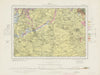


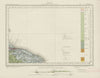


Coloured by what lies beneath the ground rather than by roads and boundaries, these sheets of the Geological Survey of England and Wales record rock formations, faults and superficial deposits. Published between 1947 and 1968, they belong to the national survey tradition begun in the nineteenth century. They cover the districts around Taunton, Selby, Hastings and Dorchester, mapping the rocks beneath the Quantocks, the Yorkshire lowlands, the High Weald and the Dorset Downs, while the topographical base keeps towns, river valleys and countryside easy to locate.
EU orders up to €150 are sent VAT- and duty-paid — no additional taxes on arrival
Authenticity Guaranteed - We only sell original antique & vintage items
Can we help? Call us on +44-208-960-3476 • FAQs
All our products are exempt from US tariffs — no additional duties or taxes payable on arrival.


- Shop by Country
- Shop by Cartographer
- Shop Maps by Type
- Shop Prints by Subject