


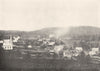
New Brunswick's oil shale and mining country are mapped in close detail in W. J. Wright's Geology of the Moncton Map-area, a Geological Survey of Canada memoir of 1922. The study covers an area that includes Westmorland and Albert counties, and broader Moncton sheets sit alongside closer mapping of the Albert Mines and the Rosevale oil-shale areas. A view of Albert Mines taken from near the manager's house shows the working landscape that the maps describe.
EU orders up to €150 are sent VAT- and duty-paid — no additional taxes on arrival
Authenticity Guaranteed - We only sell original antique & vintage items
Can we help? Call us on +44-208-960-3476 • FAQs
All our products are exempt from US tariffs — no additional duties or taxes payable on arrival.


- Shop by Country
- Shop by Cartographer
- Shop Maps by Type
- Shop Prints by Subject