
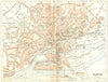


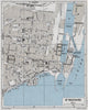


Brittany's ports and coastal excursions, mapped as France returned to travel after the war, fill these maps from Guide Bleu - Bretagne, the Hachette guide, here from 1948 and 1962 under Francis Ambrière's direction. Excursion sheets run around the peninsula from Brest and the Léon coast, Dinard to Saint-Brieuc, and Quimper towards Douarnenez and the Pointe du Raz, while plans of Nantes and Rennes show the larger cities. A plan of Saint-Nazaire explicitly records the town as it stood before the war, so the date of publication and the landscape shown can differ markedly.
EU orders up to €150 are sent VAT- and duty-paid — no additional taxes on arrival
Authenticity Guaranteed - We only sell original antique & vintage items
Can we help? Call us on +44-208-960-3476 • FAQs
All our products are exempt from US tariffs — no additional duties or taxes payable on arrival.


- Shop by Country
- Shop by Cartographer
- Shop Maps by Type
- Shop Prints by Subject