
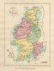

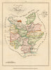

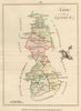

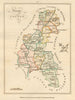

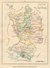

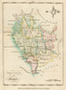

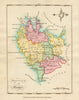

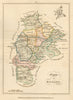

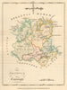

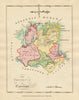

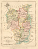

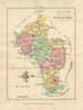

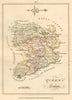

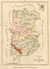

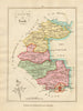

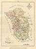

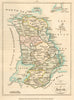

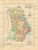

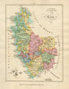

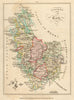

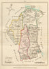

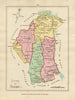

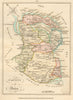

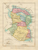

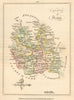

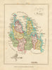

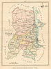

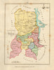

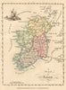

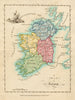

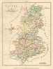

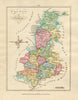

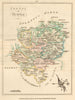

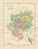

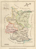

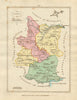
Bernard Scalé’s Hibernian Atlas; or, General Description of the Kingdom of Ireland, published on 1 February 1788 by Robert Sayer of 53 Fleet Street, London, is a significant late 18th-century cartographic work offering a decorative survey of Ireland's counties and provinces. Compiled by Scalé, a land surveyor active in Dublin, the atlas was engraved on 78 copper plates by Messrs. Ellis and Palmer. The maps are finely executed, showing topography, settlements, roads, rivers, and county boundaries, often with decorative cartouches. The Hibernian Atlas stands as one of the most visually refined atlases of Ireland before the Ordnance Survey, and the Union with Great Britain.
EU orders up to €150 are sent VAT- and duty-paid — no additional taxes on arrival
Authenticity Guaranteed - We only sell original antique & vintage items
Can we help? Call us on +44-208-960-3476 • FAQs
All our products are exempt from US tariffs — no additional duties or taxes payable on arrival.
- Shop by Country
- Shop by Cartographer
- Shop Maps by Type
- Shop Prints by Subject