


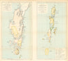

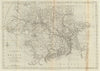


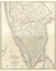


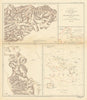











From early European outlines to detailed surveys, railway networks and the boundaries of independence, these maps follow India's changing shape. Those issued under British rule often take in territories now in Pakistan and Bangladesh, so their names and provincial divisions are part of the story. Survey of India sheets record towns, rivers and frontier districts at a different scale from the atlas maps of Bartholomew and other publishers. The prints show the ghats of Varanasi, Himalayan hill stations, temples, palaces and street life, and plates of Indian birds appear alongside studies of the Gangetic dolphin and other animals of the subcontinent.
EU orders up to €150 are sent VAT- and duty-paid — no additional taxes on arrival
Authenticity Guaranteed - We only sell original antique & vintage items
Can we help? Call us on +44-208-960-3476 • FAQs
All our products are exempt from US tariffs — no additional duties or taxes payable on arrival.


- Shop by Country
- Shop by Cartographer
- Shop Maps by Type
- Shop Prints by Subject