


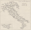


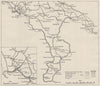


Italy's terrain, transport and economy were mapped for wartime reference in the Naval Intelligence Division's Geographical Handbook Series, issued in volumes in 1944–45. The maps go far beyond military movement, covering population, rural settlement, electricity supply, agriculture and communications. Railways cross the peninsula, navigable waterways follow the Po basin and landform studies separate the Alps, the Apennines and the south, while other sheets record reclamation schemes, wine districts, ecclesiastical divisions and Roman roads, with Sicily and Istria included. Statistical maps may reflect earlier censuses, such as population change between 1871 and 1931.
EU orders up to €150 are sent VAT- and duty-paid — no additional taxes on arrival
Authenticity Guaranteed - We only sell original antique & vintage items
Can we help? Call us on +44-208-960-3476 • FAQs
All our products are exempt from US tariffs — no additional duties or taxes payable on arrival.


- Shop by Country
- Shop by Cartographer
- Shop Maps by Type
- Shop Prints by Subject