


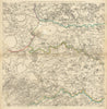


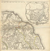


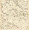


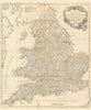


Yorkshire's roads, towns and coast take pride of place among these maps by Thomas Jefferys, geographer to George III. Jefferys (c.1719–1771) worked in London as an engraver, cartographer and publisher, and the collection includes detailed sections of his county survey of Yorkshire, with plans of York, Leeds, Sheffield, Hull, Scarborough and Ripon and wide coverage of the Dales, the North York Moors and the coast towards Flamborough. His business ranged much further, and other sheets reach the Caribbean, the Baltic, the East Indies and the fortresses of Europe, alongside smaller magazine maps and scientific diagrams. Some impressions were issued after his death, as his plates continued in use.
EU orders up to €150 are sent VAT- and duty-paid — no additional taxes on arrival
Authenticity Guaranteed - We only sell original antique & vintage items
Can we help? Call us on +44-208-960-3476 • FAQs
All our products are exempt from US tariffs — no additional duties or taxes payable on arrival.


- Shop by Country
- Shop by Cartographer
- Shop Maps by Type
- Shop Prints by Subject