
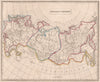

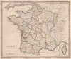


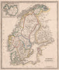

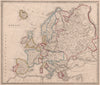


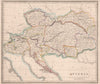


Original outline colouring and inherited political borders give Thomas Johnson's maps their mid-Victorian character, for some sheets keep territorial arrangements that had already changed by the time they were printed. Johnson was the Manchester and London publisher of A New General Atlas, represented here by material dated 1850. The maps range from European provinces and the Russian Empire to Egypt, the Nile valley and wider Asia, with older names such as Hindoostan, Tartary and the Duchy of Savoy taken from their sources. He should not be confused with the later American Johnson atlases, which came from a different business.
EU orders up to €150 are sent VAT- and duty-paid — no additional taxes on arrival
Authenticity Guaranteed - We only sell original antique & vintage items
Can we help? Call us on +44-208-960-3476 • FAQs
All our products are exempt from US tariffs — no additional duties or taxes payable on arrival.


- Shop by Country
- Shop by Cartographer
- Shop Maps by Type
- Shop Prints by Subject