
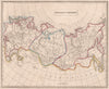

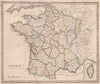


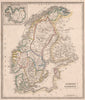

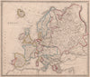


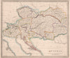


The Republic of Texas still appears on the North American sheets of Johnson's New General Atlas, a striking reminder that a map's printing date and its political information do not always match. Thomas Johnson issued the atlas in Manchester and London, and the maps here are dated 1850. Original outline colouring marks political divisions across continents, countries and empires; Europe includes pre-unification Italy and the provinces of France, and Asia appears under names such as Hindoostan and Tartary. Comparative diagrams of mountain heights and river lengths add another dimension.
EU orders up to €150 are sent VAT- and duty-paid — no additional taxes on arrival
Authenticity Guaranteed - We only sell original antique & vintage items
Can we help? Call us on +44-208-960-3476 • FAQs
All our products are exempt from US tariffs — no additional duties or taxes payable on arrival.


- Shop by Country
- Shop by Cartographer
- Shop Maps by Type
- Shop Prints by Subject