
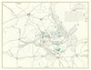


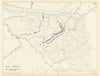

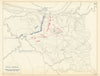

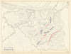

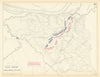


Bull Run, Beaver Dam Creek and the operations around Forts Henry and Donelson unfold day by day in Edward J. Krasnoborski's maps of the American Civil War. Associated with military atlas cartography at the United States Military Academy, he is represented here by maps published in 1959. Separate sheets name particular days or times, so a developing operation can be followed rather than seen in a single general battle outline. They are twentieth-century reconstructions of nineteenth-century events, best read alongside a campaign narrative.
EU orders up to €150 are sent VAT- and duty-paid — no additional taxes on arrival
Authenticity Guaranteed - We only sell original antique & vintage items
Can we help? Call us on +44-208-960-3476 • FAQs
All our products are exempt from US tariffs — no additional duties or taxes payable on arrival.


- Shop by Country
- Shop by Cartographer
- Shop Maps by Type
- Shop Prints by Subject