


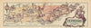


California, Louisiana and Manhattan appear in Jacques Liozu's compact state maps for French readers, taken from Les États-Unis d'Amérique, published in Paris in 1946. Under the direction of Doré Ogrizek, the illustrated volume gathered writing by several contributors, translated by Janine Ribes, with artwork by Liozu and other illustrators. The maps cover New England, the Atlantic states, the South, the Midwest and the West, placing Arizona and Colorado in the same series as Maine, Rhode Island and the Dakotas, and city maps add Manhattan and San Francisco. Each state is presented as a destination in its own right, in a book from the first years after the war.
EU orders up to €150 are sent VAT- and duty-paid — no additional taxes on arrival
Authenticity Guaranteed - We only sell original antique & vintage items
Can we help? Call us on +44-208-960-3476 • FAQs
All our products are exempt from US tariffs — no additional duties or taxes payable on arrival.


- Shop by Country
- Shop by Cartographer
- Shop Maps by Type
- Shop Prints by Subject