


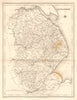


Elegant steel-engraved county maps and city plans make up this collection of antique maps by Samuel Lewis and Robert Creighton, published around 1840 in Lewis's topographical dictionaries of England, Wales and Ireland. Creighton drew the maps, which were engraved by J. & C. Walker, Thomas Starling and others for Lewis as publisher. They show county boundaries, hundreds, roads, canals and parliamentary divisions in Yorkshire, Lancashire, Cornwall, Kent and Devonshire, and in Welsh counties such as Glamorganshire, Pembroke and Anglesey, with Jersey and plans of London and its environs.
EU orders up to €150 are sent VAT- and duty-paid — no additional taxes on arrival
Authenticity Guaranteed - We only sell original antique & vintage items
Can we help? Call us on +44-208-960-3476 • FAQs
All our products are exempt from US tariffs — no additional duties or taxes payable on arrival.


- Shop by Country
- Shop by Cartographer
- Shop Maps by Type
- Shop Prints by Subject