


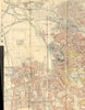





Published by Macmillan in 1902 as part of Charles Booth’s monumental Life and Labour of the People in London, these maps are landmarks of social cartography. Booth and his investigators spent years gathering evidence through census data, School Board records and street-by-street walks with local police. On the famous poverty sheets, every street is colour-coded from black and dark blue for the poorest districts through pink and red to yellow for the wealthy, making London’s inequalities immediately visible. Other maps chart the institutions—churches, schools, pubs and places of entertainment—that shaped urban life. Covering neighbourhoods from Hammersmith to Woolwich, the maps turn Booth’s vast inquiry into a compelling visual record of Edwardian London and helped establish systematic social investigation as an instrument of reform.
EU orders up to €150 are sent VAT- and duty-paid — no additional taxes on arrival
Authenticity Guaranteed - We only sell original antique & vintage items
Can we help? Call us on +44-208-960-3476 • FAQs
All our products are exempt from US tariffs — no additional duties or taxes payable on arrival.


- Shop by Country
- Shop by Cartographer
- Shop Maps by Type
- Shop Prints by Subject