


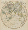

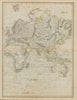
The Republic of Texas, the divided Polish territories and the Kingdom of Sardinia survive on the world atlas sheets that make up most of the maps by William Home Lizars, the Edinburgh painter, engraver and publisher who lived from 1788 to 1859. Catalogued to 1842, they range from the British Isles and continental Europe to the Americas, Africa, Asia and the Pacific, and older French departmental arrangements preserve another stage of nineteenth-century atlas-making. British sheets give prominence to railways and coaching roads, ocean charts and colonial regions widen the scope, and a comparative table turns to mountain chains and summit heights.
EU orders up to €150 are sent VAT- and duty-paid — no additional taxes on arrival
Authenticity Guaranteed - We only sell original antique & vintage items
Can we help? Call us on +44-208-960-3476 • FAQs
All our products are exempt from US tariffs — no additional duties or taxes payable on arrival.


- Shop by Country
- Shop by Cartographer
- Shop Maps by Type
- Shop Prints by Subject