


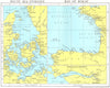


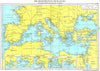

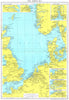


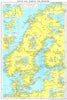


Ports, estuaries, canals and the world's stormy seas are charted for shipping in the eighth edition of Lloyd's Maritime Atlas, published by the Corporation of Lloyd's in London in 1971. Regional sheets cover the North Sea, the Mediterranean, the Indian Ocean, the Pacific and the Atlantic coasts, with insets of the Thames, Humber, Elbe and Weser and the approaches to Rotterdam. The Suez and Panama canals and the Manchester Ship Canal appear in detail, and a world map shows where and when bad weather is to be expected.
EU orders up to €150 are sent VAT- and duty-paid — no additional taxes on arrival
Authenticity Guaranteed - We only sell original antique & vintage items
Can we help? Call us on +44-208-960-3476 • FAQs
All our products are exempt from US tariffs — no additional duties or taxes payable on arrival.


- Shop by Country
- Shop by Cartographer
- Shop Maps by Type
- Shop Prints by Subject