


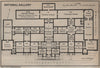


Baedeker's visitors needed to find both a London street and the right part of a museum, and the maps in London & its environs did both. The examples here, dated 1905 to 1930, combine district maps with plans of public buildings, galleries, churches and excursions. Railway, Underground and tramway diagrams link central London, the City and the suburbs, while the British Museum, National Gallery, St Paul's, Westminster Abbey and the South Kensington museums are planned inside as well as out. Windsor, Hampton Court, Kew and St Albans carry the itinerary beyond the centre, and some plans show arrangements since altered by redevelopment or institutional change.
EU orders up to €150 are sent VAT- and duty-paid — no additional taxes on arrival
Authenticity Guaranteed - We only sell original antique & vintage items
Can we help? Call us on +44-208-960-3476 • FAQs
All our products are exempt from US tariffs — no additional duties or taxes payable on arrival.


- Shop by Country
- Shop by Cartographer
- Shop Maps by Type
- Shop Prints by Subject