


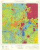

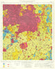


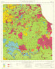


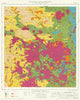


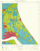


Farmland quality became a matter for maps and planning in the vintage maps issued by the Ministry of Agriculture, Fisheries and Food, chiefly the provisional Agricultural Land Classification series of the late 1960s and 1970s. The ministry's Agricultural Land Service prepared the grading with help from the National Agricultural Advisory Service and the Soil Survey of England and Wales, overprinting it on Ordnance Survey topography so that land quality can be read against familiar towns, valleys and uplands. Coverage runs from Northumberland and the Yorkshire Wolds to the Fens, the Suffolk claylands, the Cotswolds and Devon, before later surveys subdivided Grade 3. An Ordnance Survey index shows how the numbered sheets fit together.
EU orders up to €150 are sent VAT- and duty-paid — no additional taxes on arrival
Authenticity Guaranteed - We only sell original antique & vintage items
Can we help? Call us on +44-208-960-3476 • FAQs
All our products are exempt from US tariffs — no additional duties or taxes payable on arrival.


- Shop by Country
- Shop by Cartographer
- Shop Maps by Type
- Shop Prints by Subject