


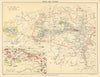


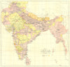

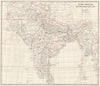

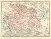


Cantonments, hill stations and the plan of the Taj Mahal set these maps from Murray's India handbook apart from an ordinary atlas of South Asia. John Murray's guide, published in London and associated with Thacker, Spink & Co. in Calcutta, covered India, Burma and Ceylon with the princely states and European possessions; the eleventh edition is identified, and the material dates from 1905 to 1965. City plans keep period names such as Bombay, Rangoon, Cawnpur and Simla, railway and regional sheets link the destinations, plans of palaces and mosques guide visitors round individual buildings, and military maps follow the frontier districts and the fighting of 1857.
EU orders up to €150 are sent VAT- and duty-paid — no additional taxes on arrival
Authenticity Guaranteed - We only sell original antique & vintage items
Can we help? Call us on +44-208-960-3476 • FAQs
All our products are exempt from US tariffs — no additional duties or taxes payable on arrival.


- Shop by Country
- Shop by Cartographer
- Shop Maps by Type
- Shop Prints by Subject