


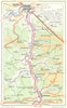

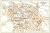


Town plans of Antwerp, Brussels, Bruges and Ghent and maps of the Meuse, Semois and Lesse valleys make up the maps from Nagel's Belgium & Luxemburg, the guidebook published by Nagel and Co. in 1950. Liège, Leuven, Namur, Tournai and Ostend also have plans, some cities with both inner-city and general coverage, and the descriptions give French and Dutch place names. The valley maps lead to Dinant, Bouillon and Han-sur-Lesse, and Luxembourg has its own coverage alongside the regional map.
EU orders up to €150 are sent VAT- and duty-paid — no additional taxes on arrival
Authenticity Guaranteed - We only sell original antique & vintage items
Can we help? Call us on +44-208-960-3476 • FAQs
All our products are exempt from US tariffs — no additional duties or taxes payable on arrival.


- Shop by Country
- Shop by Cartographer
- Shop Maps by Type
- Shop Prints by Subject