
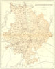

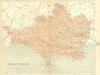

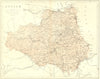

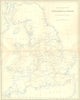

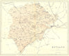

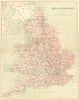
County maps and sheets of railways and canals supported the entries of a Victorian topographical dictionary, the National Gazetteer of Great Britain & Ireland, published by Virtue & Co. in 1870 and edited by N. E. S. A. Hamilton. Huntingdonshire, Dorset, Durham and Rutland appear as individual counties, while broader sheets show the railways and inland navigation of England and Wales at a time when the network was fully mature.
EU orders up to €150 are sent VAT- and duty-paid — no additional taxes on arrival
Authenticity Guaranteed - We only sell original antique & vintage items
Can we help? Call us on +44-208-960-3476 • FAQs
All our products are exempt from US tariffs — no additional duties or taxes payable on arrival.


- Shop by Country
- Shop by Cartographer
- Shop Maps by Type
- Shop Prints by Subject