


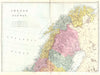


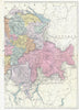


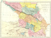


The world of 1895 is laid out in a single consistent style in these maps from New Complete Atlas of the World, published in London by George W. Bacon. Larger countries are divided into regional sections, with continental and world maps for an overview, so neighbouring areas can be compared directly. Europe appears through the German and Austro-Hungarian empires, colonial territories shape much of Africa, Asia and the Caribbean, and the Australian colonies, Canadian provinces and New Zealand are treated separately, along with island groups and small dependencies that vanish on broader maps. Mediterranean steamship routes and telegraph cables link the political map to communications.
EU orders up to €150 are sent VAT- and duty-paid — no additional taxes on arrival
Authenticity Guaranteed - We only sell original antique & vintage items
Can we help? Call us on +44-208-960-3476 • FAQs
All our products are exempt from US tariffs — no additional duties or taxes payable on arrival.


- Shop by Country
- Shop by Cartographer
- Shop Maps by Type
- Shop Prints by Subject