





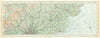


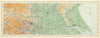


England and Wales in the early days of motoring, mapped continuously from Cornwall to the Scottish border, fill the sheets of the Ordnance Survey Atlas of England & Wales. Those here are dated 1922 and were printed at the Ordnance Survey Office in Southampton, using a quarter-inch-to-the-mile framework that shows broad areas rather than simple county outlines. Mountains, coastlines, towns and roads share each regional sheet, often crossing county boundaries so that roads and relief run on without a break. Snowdonia, the Lake District, the Pennines and the Fens show the variety of the terrain in the years before the motorway network.
EU orders up to €150 are sent VAT- and duty-paid — no additional taxes on arrival
Authenticity Guaranteed - We only sell original antique & vintage items
Can we help? Call us on +44-208-960-3476 • FAQs
All our products are exempt from US tariffs — no additional duties or taxes payable on arrival.


- Shop by Country
- Shop by Cartographer
- Shop Maps by Type
- Shop Prints by Subject