


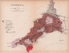


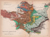


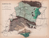


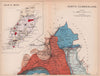


Familiar county outlines become the framework for Britain's rocks and formations in Reynolds's Geological Atlas of Great Britain, a compact Victorian guide to the nation's geology. The edition here is dated 1864 and bears the name of the London publisher James Reynolds. Its maps cover the English counties, singly or in groups, together with Wales and Scotland, running from Cornwall and Devon to the Lake District, Cumberland and Northumberland. Towns and boundaries remain visible beneath the geological colouring, so the sheets appeal equally to collectors of county maps and to anyone interested in the rise of popular earth science.
EU orders up to €150 are sent VAT- and duty-paid — no additional taxes on arrival
Authenticity Guaranteed - We only sell original antique & vintage items
Can we help? Call us on +44-208-960-3476 • FAQs
All our products are exempt from US tariffs — no additional duties or taxes payable on arrival.


- Shop by Country
- Shop by Cartographer
- Shop Maps by Type
- Shop Prints by Subject