
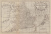


From a single Welsh county to the whole of Asia, these antique maps by George Rollos show the range of English map publishing between about 1759 and 1769. England and Wales and Brecknockshire sit beside Germany divided into its imperial circles, Upper Saxony and the Lower Rhine, together with France, the Netherlands, Asia, Africa and the Americas. Several maps acknowledge the French cartographer Robert as their source, and the selection reaches well beyond the county maps associated with England Displayed.
EU orders up to €150 are sent VAT- and duty-paid — no additional taxes on arrival
Authenticity Guaranteed - We only sell original antique & vintage items
Can we help? Call us on +44-208-960-3476 • FAQs
All our products are exempt from US tariffs — no additional duties or taxes payable on arrival.


- Shop by Country
- Shop by Cartographer
- Shop Maps by Type
- Shop Prints by Subject