


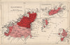


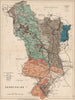


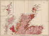


Geological maps paired with plates of fossils make Stanford's Geological Atlas a handsome guide to what lies beneath the landscapes of the British Isles. Issued between 1880 and 1913, the atlas covers the English counties, Wales, Scotland and Ireland, with regional sheets for the Lake District, Yorkshire and Lancashire, mapping rock formations in place of political divisions. The fossil plates run from Silurian and Permian material through the Triassic and Cretaceous to the Eocene, including the Purbeck, Wealden, Woolwich and Reading beds, so each group of organisms is tied to a named layer of rock.
EU orders up to €150 are sent VAT- and duty-paid — no additional taxes on arrival
Authenticity Guaranteed - We only sell original antique & vintage items
Can we help? Call us on +44-208-960-3476 • FAQs
All our products are exempt from US tariffs — no additional duties or taxes payable on arrival.


- Shop by Country
- Shop by Cartographer
- Shop Maps by Type
- Shop Prints by Subject