


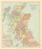


The Free City of Danzig, the Saar Basin and the Tangier International Zone appear in these maps from Stanford's London Atlas of Universal Geography, Whitehall Edition, which captures the redrawn world of 1925. Published in London by Edward Stanford, the world reference atlas includes Czechoslovakia and the territories transferred after the First World War, with wider sheets covering the Soviet Union, British India, the Americas, Africa and Australasia. Japan's possessions and Pacific mandates and the colonial divisions of Africa record the political order of the time, and France, Great Britain and the United States are divided across several sheets. Railways and provincial and national boundaries organise the reference information.
EU orders up to €150 are sent VAT- and duty-paid — no additional taxes on arrival
Authenticity Guaranteed - We only sell original antique & vintage items
Can we help? Call us on +44-208-960-3476 • FAQs
All our products are exempt from US tariffs — no additional duties or taxes payable on arrival.


- Shop by Country
- Shop by Cartographer
- Shop Maps by Type
- Shop Prints by Subject